Ground Zero — 09.23.01

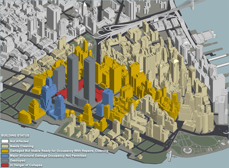
Axonometric survey map of Lower Manhattan colour-coding each building by damage status, from not affected through to destroyed.
Police and National Guard at a street barricade; a hand-added caption points to a gutted building that had been a Borders bookstore.
A crowd on Duane Street looking down the avenue; a caption points to the smoking debris pile, noted as nearly ten storeys high.
Police at a chain-link barricade with captions marking the Century 21 department store and the remaining facade of the World Trade Center.
Looking down a narrow street toward the site: smoke still rising, a gutted building standing beyond the barricade, police and workers at a chain-link fence in the foreground.
A decorative globe in a shop window on Broadway at John Street, thickly coated in dust.
A shop window near a barricade, its glass grey with settled dust.
Two Citizen wristwatches on a shop window display, faces and bracelets buried under dust, the price card beside them still legible.
A street view uptown from the site with two green arrows drawn in to mark approximately where each tower stood.
Onlookers behind a barrier watching a flatbed truck carry a section of steel away from the site.
A long section of twisted structural steel from the towers resting on a flatbed trailer.
A view toward the site along the waterfront, with arrows marking the approximate tower locations against the remaining skyline.

back to the first page